
Ask five North Upper Truckee neighbors where their trail system starts and you'll get two different answers, and neither one is wrong. Depending on which end of the neighborhood you live in, "trails right out the door" means something entirely different. One door opens onto a low, shaded network that connects to Heavenly's base. The other opens onto an alpine meadow above 7,300 feet that only exists half the year. Most people who've lived here for a decade have only ever walked through one of them.
That split isn't a minor detail. It changes which trails you can reach on a Tuesday evening after work, which ones disappear under a locked gate every winter, and which road construction project is slowing your commute to the trailhead this fall.
If your street feeds into Pioneer Trail near Oneidas Street, you're plugged into the Corral system. Head up Oneidas and it turns into a paved forest service road that runs to a dirt parking area, the entry point for a dense web of singletrack: Powerline Trail tracing the base of Heavenly Ski Area, Cold Creek splitting into a mellow lower half and a rockier upper climb, and the Corral cluster itself, made up of Incense Cedar, Upper Corral, Sidewinder, Cedar, and the Armstrong Connector. This is the low-elevation, tree-covered side of the neighborhood's trail identity. It's rideable and walkable most of the year, shuttled easily by car along Fountain Place, and forgiving enough for a family testing limits alongside someone in full downhill gear.
If your street instead pushes you south toward Highway 89 and Luther Pass, your front door is Big Meadow Trailhead, about ten miles out. This is a different experience entirely. The trailhead sits above 7,300 feet, opens into a wildflower meadow, and serves as one of the entrances to the Tahoe Rim Trail. From here you can walk or ride to Round Lake, whose basin sits below a dramatic volcanic formation known locally as the Elephant's Back, or continue to Dardanelles Lake, ringed in white granite. Push further and the trail links to Freel Peak by way of Saxon Creek and the Armstrong Connector, essentially the far end of the same trail web the Oneidas Street side accesses, just reached from the opposite direction after considerably more climbing.
Here's the comparison most residents never get, because they've only ever used one entrance:
| High Meadow / Oneidas Street side | Big Meadow Trailhead | |
|---|---|---|
| Access | Paved forest road off Pioneer Trail | Gated dirt road off Highway 89, Luther Pass |
| Elevation feel | Base of Heavenly, mostly under tree cover | Above 7,300 feet, open meadow and ridgeline |
| Connects to | Powerline, Cold Creek, Corral cluster, Armstrong Connector | Tahoe Rim Trail toward Round Lake, Dardanelles Lake, Freel Peak |
| Season | Usable most of the year, closes only in heavy snow | Gated and closed through winter, no restroom or trash service off-season |
The two systems do connect, eventually, through a long loop that climbs Fountain Place, follows the Tahoe Rim Trail, and descends through Mr. Toad's Wild Ride, a route some locals stretch even further into Kingsbury Grade for what's known as the "Punisher." But that's a twenty-to-thirty-mile undertaking, not a casual evening walk. For daily use, the two front doors stay separate, and knowing which one is actually yours saves a lot of wasted drive time.
If your route to the Corral system runs along Pioneer Trail, plan for delays through October. South Tahoe Public Utility District started construction this August on a waterline replacement project along Pioneer Trail between Sierra House Elementary School and Susquehanna Drive, with a staging area at the corner of Pioneer Trail and Black Bart Avenue. The work brings one-lane traffic control to that stretch, and while access to homes and driveways stays open, anyone using Pioneer Trail to reach Oneidas Street should build in extra time before a ride or hike.
Worth checking before you head out this month: the project is expected to run through October, so a route that normally takes ten minutes to the trailhead parking area might not this fall.
The gate at Big Meadow Trailhead isn't symbolic. The access road closes for the season, and once the snow settles in, the alpine half of the neighborhood's trail identity effectively disappears until it reopens the following year. That's the tradeoff for the views. You get Round Lake and Freel Peak in summer, but you lose the whole system for months at a time.
The Oneidas Street side stays theoretically open longer, but North Upper Truckee Road itself isn't immune to winter. During heavy snow events, the road has been closed at Sawmill, cutting off through-traffic entirely until crews clear it. It's the kind of detail that never shows up in a trail guide but matters enormously if you're planning to get out the door on a storm day.
There's a smaller, more mundane sign of just how seasonal this neighborhood's rhythm really is: local snow removal outfits build their fall marketing around it. Catch My Drift Snow Removal, one of the services that plows this pocket of town, opens its early-season signups by naming the specific neighborhoods it covers, Gardner Mountain, the Y, North and South Upper Truckee, Meyers, and Pioneer. That a plowing company markets by neighborhood name rather than a general South Shore radius tells you something real: winter access here isn't uniform, and residents already know it varies street by street.
None of this is really about trails. It's about the fact that North Upper Truckee doesn't behave like one neighborhood with one seasonal rhythm. It behaves like two, stitched together by a road that sometimes closes and a gate that always does. The Oneidas Street side gives you a lower, shadier, more forgiving trail system that mostly stays open. The Big Meadow side gives you the alpine views everyone associates with this part of the South Shore, but only for part of the year, and only once the gate comes off.
If you've only ever used one entrance, the other one is closer than you think, and worth learning before the next storm or the next construction notice makes the decision for you.
Know someone weighing a move to this side of the lake, or curious how North Upper Truckee compares to a neighboring pocket of the South Shore? The team at Jill & Pamela spends as much time on these trails as anyone, and we're always glad to talk through what a street actually offers before you commit to it. Start Your Tahoe Home Search whenever you're ready.
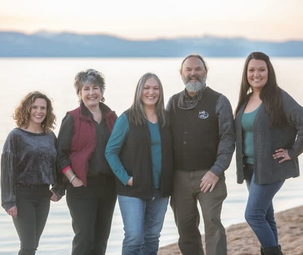
SoTahoe Team
We serve clients in California and
Nevada, forging lasting relationships
built on trust and integrity.
Office Information
2028 Lake Tahoe Blvd.,
South Lake Tahoe, CA 96150